What you need to know
- Google can now show you the approximate impact area of an active wildfire in Search and Maps.
- The feature was piloted in California last year and is now available across the U.S.
- It uses data from NOAA's GOES satellites and the Google Earth Engine.
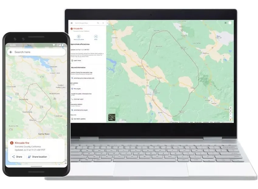
With an aim to provide high-quality information to people during active wildfires, Google today introduced a new wildfire boundary map in Search and Maps in the U.S. You can now search for the name of an active wildfire on your phone or PC to view a map with the approximate boundary of the fire in near real-time, along with other helpful resources from local emergency agencies.
Yossi Matias, VP Engineering & Crisis Response Lead at Google, wrote in a blog post:
In moments like a growing wildfire, knowing exactly where a blaze is underway and how to avoid it is critical. Using satellite data to create a wildfire boundary map, people will now see the approximate size and location right on their phone or desktop.
If you're using Google Maps, you will be able to view the same information and also receive warnings when approaching an active blaze. Google will also send ambient alerts to people exploring areas that are near an active wildfire. In case there are multiple large fires in the same region, you may see several red boundaries in Search and Maps.

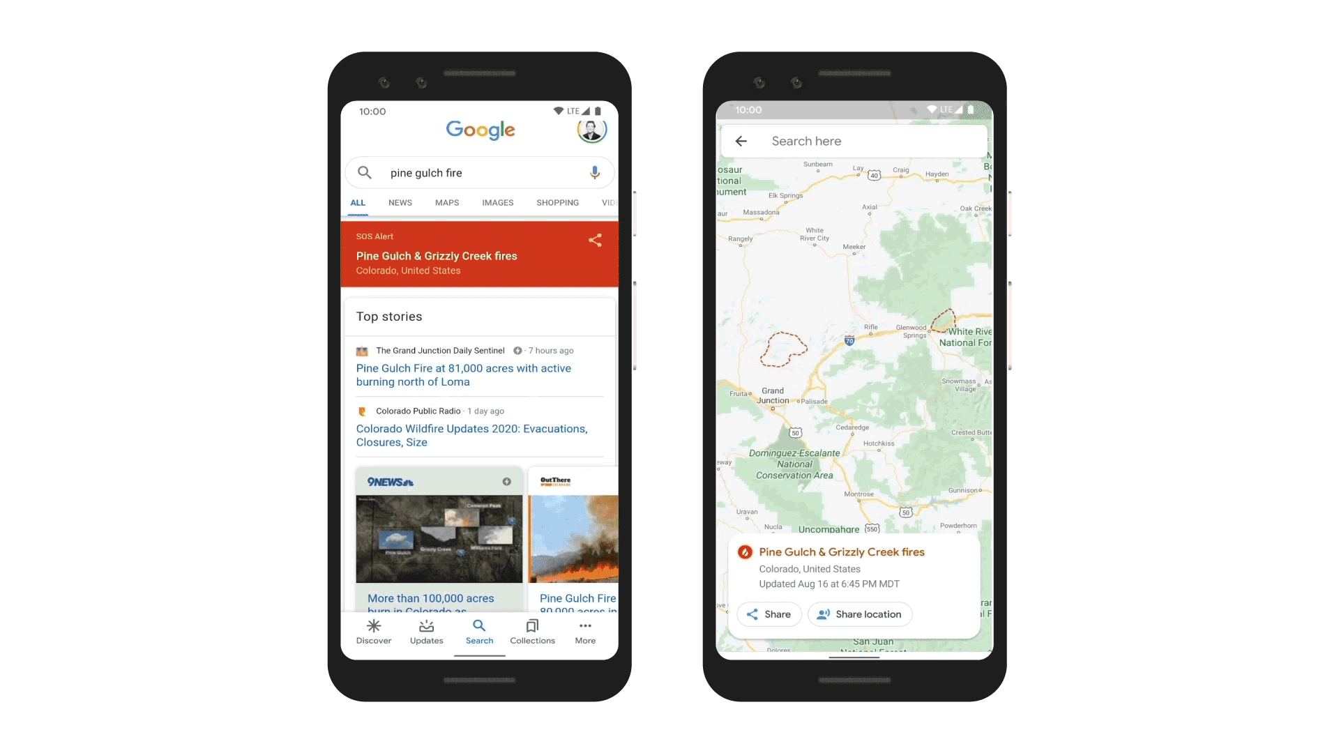
To show the approximate boundaries of a wildfire in near real-time, Google uses satellite data from the National Oceanic and Atmospheric Administration's (NOAA) GOES satellites and data analysis capacities of the Google Earth Engine. Google says the data from NOAA's satellites is refreshed every hour.
Google Maps update brings a colorful redesign with more detailed imagery

