We know Google has been hard at work mapping the entire world with a combination of different satellite footage, but how much of that area is also covered by first person Street View imagery? On its "About Street View" page, Google has published a map that pretty granularly shows off where it has collected Street View imagery, and the number of places currently mapped may be surprising.
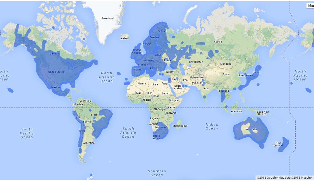
The interactive map (which can be zoomed, but in only partially) shows blue shaded areas where someone has personally driven, rode or walked with Google's Street View equipment to provide high-res 360-degree pictures of the area. Most of the U.S., Canada, Europe, Australia, Korea and Japan are mapped, naturally, but so are more obscure ares like small island chains far into the ocean.
When looking at the complete map, however, you may be wondering how long it will be before Google fills in some massive gaps in Street View. Huge areas like China, Russia, India, Africa and most of South America have no Street View data at this time. Through its various new methods such as Street View Trekker, Google is working to expand the amount of data it has around the world, but as you would expect its a massive undertaking in terms of human effort.

If you're interested in taking a better look at the map of Street View data, head to the source link and scroll down to the "Where is Street View" heading. While you're there, you can find even more information about how Google collects its data.
Source: About Street View

